
Brown County ZIP Coverage
Official GIS, Census geography, and Wisconsin ZIP-class material identify 24 postal codes that occur in or intersect Brown County. This is a research index, not a promise that every code serves every parcel. The post office column below uses the common postal label, while the notes preserve boundary and class cautions.
| ZIP | Brown County area | Postal label | Boundary or class note |
|---|---|---|---|
| 54110 | Rural eastern overlap | Brillion | Verify county and municipality by address |
| 54115 | De Pere, Ashwaubenon, Hobart area | De Pere | De Pere preferred; Ashwaubenon and Hobart acceptable |
| 54126 | Greenleaf and rural area | Greenleaf | Postal area differs from village boundary |
| 54130 | Southern edge overlap | Kaukauna | Extends beyond Brown County |
| 54155 | Oneida area | Oneida | Check reservation and municipal jurisdiction separately |
| 54162, 54165 | Northwest and west overlaps | Pulaski, Seymour | Multi-county postal geography |
| 54173, 54180 | Suamico and Wrightstown areas | Suamico, Wrightstown | Village, town, and postal lines differ |
| 54208, 54217, 54229 | Denmark, eastern rural areas, New Franken | Denmark, Luxemburg, New Franken | Postal labels do not establish municipality |
| 54301-54304, 54311, 54313 | Green Bay delivery areas | Green Bay | Standard ZIPs; 54313 may touch adjacent municipalities |
| 54305-54308, 54324 | Green Bay postal service | Green Bay | Post-office or PO Box use, not situs proof |
| 54344 | Green Bay unique use | Green Bay | Unique class; verify the delivery address |
The source set does not provide one clean, current, parcel-level USPS list for the whole county. Confirm any actual delivery point with USPS, and keep the access date. Grouped rows save space but do not imply that neighboring ZIP codes share one boundary or one post office.
Search Brown County ZIP Codes
The official USPS ZIP Code Lookup offers three distinct modes. Choose the mode that matches the question, enter a full unit when one exists, and save the returned city, state, code, and date. USPS warns that a result does not confirm that a person or company is present at the address.
| USPS search mode | Input | Use in Brown County |
|---|---|---|
| By Address | Street, unit, city and state | Normalize one delivery point |
| By City & State | Postal city and Wisconsin | View codes linked to a postal label |
| Cities by ZIP | Five-digit ZIP | See preferred and acceptable city labels |
The USPS lookup screen shown here is the live source for delivery labels.
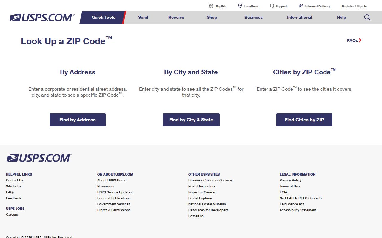
The three modes answer different questions, so preserve which one produced the result instead of copying only the five digits.
Brown County Postal City Labels
The Wisconsin DHS ZIP class and city table explains one common mismatch. For 54115, De Pere is the preferred city name, while Ashwaubenon and Hobart appear as acceptable names. Those labels help mail reach a destination. They do not settle which city, village, or town has legal jurisdiction.
Keep two fields in a research note: the exact city returned by USPS and the legal municipality shown by the parcel and boundary systems. Add the county as a third field. This simple separation prevents a Green Bay postal label from being treated as proof that an address lies inside Green Bay.
Find Brown County Residents by ZIP
A Brown County ZIP code directory narrows the search area before an official record is checked. It should not be used as a resident list. Start with a verified delivery label, identify the local government that covers the address, and then use the record source tied to the actual question.
- Run the complete address, including unit, through USPS and save the returned postal label and date.
- Compare the situs address in Brown County Property Listing. Situs means the physical location, which can differ from the owner's mailing address.
- Open BrownDog and compare parcel, municipality, and boundary layers. Keep the parcel ID with the result.
- Use MyVote's address mode only to identify voter jurisdiction, not to claim who occupies the address.
- Route the next request to the city, village, town, county, library, or archive that holds the dated record.
Once the area has been reduced to named roads, the Brown County street directory provides the address-level workflow. A ZIP-wide result remains too broad for most parcel or historical claims.
Map Brown County ZIP Boundaries
Green Bay publishes a ZIP Codes Map entry through its GIS maps page. Brown County's Land Information Office also keeps an archived ZIP geometry package in its boundary archive. These resources are useful for visual overlap, but the archived package name includes 2011 and should not replace a current USPS result.
The Green Bay GIS map list provides the official city entry point captured for ZIP research.
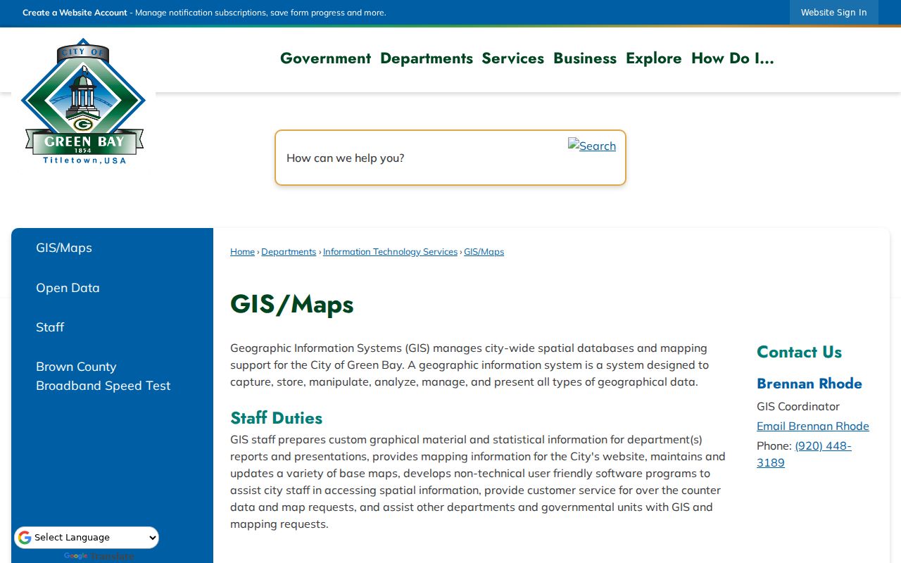
The city map gives visual context for Green Bay, while county parcel and municipal layers are still needed outside the city and along shared edges.
Wisconsin DOA links a 2020 list of ZIP Code Tabulation Areas by county and municipality. A ZCTA is a Census approximation built for statistics. It is not the same thing as the live USPS delivery network, so label it as Census geography whenever it is used.
Brown County ZIP Boundary Limits
Brown County contains cities, villages, and towns with their own clerks, assessors, courts, and addressing roles. ZIP lines follow mail delivery needs. Municipal lines define local government. Parcel lines describe land. These systems may overlap, but they answer different questions.
- ZIP code
- A USPS delivery code associated with addresses and mail routes, not a legal municipal boundary.
- ZIP+4
- A more specific delivery segment added to the five-digit code for a block, group, or high-volume recipient.
- PO Box ZIP
- A code used for post-office boxes; it does not identify the physical site of a person or parcel.
- Unique ZIP
- A code assigned for a specific high-volume use rather than a general neighborhood.
- Carrier route
- A mail-delivery path that may cross boundaries used by local government or Census geography.
- ZCTA
- A Census-created statistical area that approximates ZIP geography.
Brown County Planning issues new addresses in the towns of Green Bay, Eaton, Pittsfield, New Denmark, Holland, and Glenmore, plus the Village of Denmark. Other municipalities handle their own addressing. An address anomaly should go to the responsible municipality, not automatically to the county.
Brown County PO Box ZIPs
The ZIP-class table marks standard, post-office-only, and unique categories. Green Bay codes 54305 through 54308 and 54324 are associated with post-office or PO Box use in the inspected material. Code 54344 has a unique classification. Neither type should be mapped as if it described a residential neighborhood.
When a record shows only a mailing address, keep it in a mailing field. Do not copy it into the situs field. Brown County parcel research distinguishes the physical property address from the owner's mailing address, and that distinction is vital when a box number or unique ZIP appears.
Note: A PO Box can route mail, but it cannot establish where a person lived or where a parcel lies.
Brown County Rural ZIP Mismatches
Rural postal areas such as Greenleaf, Denmark, New Franken, Pulaski, Seymour, Brillion, Kaukauna, Luxemburg, Suamico, Wrightstown, and Oneida can cross or obscure local boundaries. Record the parcel's situs, postal city, municipality, and county separately. For rural land, a section, township, range, plat, or legal description may remain more stable than a postal label.
BrownDog supplies parcel and municipal context, while the relevant local clerk or addressing authority resolves jurisdiction. If a historic label is involved, search dated directories, newspapers, and maps. The research found no single official Brown County index of past postal-city changes, so an old ZIP or city label should remain unverified until archival or USPS evidence supports it.
Document Brown County ZIP Results
A useful Brown County ZIP code directory record keeps more than the code. Save the full input address, unit, returned postal city, ZIP class, legal municipality, county, parcel ID, source URL, and access date. If a map was used, add its layer name and date. This matters because live delivery assignments, parcel links, and boundary resources change.
For conflicting labels, preserve both instead of choosing the convenient one. A concise evidence trail might read: USPS postal label, parcel situs, BrownDog municipality, then custodian contacted. State what each item cannot prove. USPS does not confirm a person at an address, a parcel record does not prove occupancy, and a voter jurisdiction result does not establish ownership.
The final record should be reproducible by another researcher. That makes the Brown County ZIP code directory a geographic tool rather than a source of unsupported resident claims.